Location and climatе
The territory of the park is locked between the following geographical coordinates: 41.95 'and 42.18' N. and 27.45 'and 28.05' E.
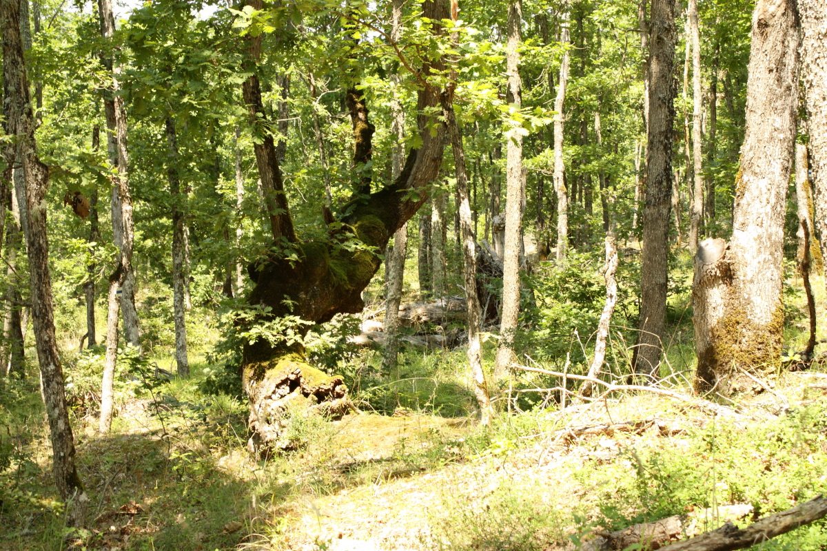
Strandja exceptional biodiversity due to the geological past of Strandja, its climate and unique geographical location - a crossroads between Europe, the Mediterranean and Asia. Specific mountain vegetation was formed before the formation of the Bosphorus Strait between Europe and Asia, in the presence of a land connection along the entire coast. This ancient plant community is called South euxeinos (from the city "Evksiniya pont" - Black Sea) or more Colchis (named after the mythical Colchis valley in Georgia, Caucasus) and incorporates areas in Strandja, northern Turkey, Caucasus and North Iran. In modern geopolitical realities as easy and natural touch to this unique, survived for millions of years biological heritage, offers Natural Park "Strandja".
In traditional notions of European naturalist diversity of plant and animal species increases in the direction from north to south. In the late nineteenth and early twentieth century Strandja restores the direction of the lost and forgotten East. Different from known and studied nature in Southern Europe, the mountain reveals ancient treasure of biological "Colchis".
Strandja avoid typical of Quaternary glaciation Europe. The unique palaeontological history of the mountain is that it retains its warm climate and relatively humid. Influenced by the proximity of the three large lakes - Black, Marmara and Aegean Sea.
Strandja avoid typical of Quaternary glaciation Europe. The unique palaeontological history of the mountain is that it retains its warm climate and relatively humid. Influenced by the proximity of the three large lakes - Black, Marmara and Aegean Sea. Among rounded ridges characteristic deep ravines and river valleys are large capillaries and arteries invigorating moisture coming every day with breeze circulation from the sea coast to the interior of Strandja. Communities so widespread in Europe a few million years ago during the Tertiary, are stored here and now have their only home on the continent.
Strandja is a "living museum" of tertiary Europe. Periwinkle - a symbol of the mountain, was popular during the warm and humid climate of the Tertiary north even to Scandinavia - in present-day Sweden. Currently is preserved only in Strandja and Caucasian region and the Atlantic coast of the Iberian Peninsula and the Canary Islands rearranged to another subspecies. Periwinkle, as most relics, it is highly vulnerable to changes in the environment and even carried a mile outside the shady shelter of ravines, it decays and dies.
An internal Strandja precipitation are higher, specific allocation monthly, tangibly feel the influence of the cold north-easterly winds, and some sections are characterized by frequent fogs. Due to lack of effective protection for cold invasions from the north and northwest into the mountains appear quite sharp frosts.
In the most general part of the Black Sea has highlighted the winter rainfall maximum and is under the influence of the Mediterranean, while in the higher mountain areas and in those of the northwest border with Turkey has emerged second maximum in May-June as a result of continental influence.
Besides the climatic differences between the coastal zone, and peripheral inner Strandja north and west of the mountain, certain climatic differences are typical for inland areas with the change in altitude westward to the main ridge. This leads to the specific distribution of Common plant species.
The local climate change represents daytime temperatures to the highest parts of Strandja. A trend of decreasing temperatures on the slopes of the higher ridges in the central part of Strandja average over 350 m asl This has a definite impact on other climatic elements - more frequent and longer-lasting fog, a heavy snowfall and a longer duration of detention of snow earlier frosts and later development of vegetation. Frequent retention of fog in these high areas during the winter months creates conditions for frost and freezing forest at altitude 500 m
The wind regime in the area is characterized by prevailing northerly winds. In coastal parts of the study area from November to March winds blow from April to August - East and in September and October - Northeast.
Breeze circulation during the summer months is the main reason for the increased frequency of easterly winds in summer. The park is characterized by a wide variety of monthly direction of the prevailing wind. Here winds prevail in January, February, March and October.
In terms studied bioclimatic region creates significant resources for climate. Healing qualities of the climate in the coastal area in conjunction with the beaches and the sea are the reasons for declaring Ahtopol climate seaside resort of national importance, and Sinemorets - Climate seaside resort of local importance.
A full medical examination of the climate in the region of Malko Tarnovo, warranting the development of tradition in climate-allergic and respiratory diseases, and the city being named mountain resort of local importance.
|
|