|
Geomorphological and paleontological past. Landscape and geomorphology
Strandja occupies the southeastern part of the Balkan Peninsula. It ends the continent of Europe and will move to Asia.
The larger and higher part of the mountain is located within the Republic of Turkey, while peak Mahiàda - its highest point (in Turkey) reaches 1031 m asl The highest peak in the Bulgarian part of Strandja is gradishte High Peak (710 meters above sea level, southwest of Malko Tarnovo).
In the Bulgarian part clearly two main ridges - Rezovsko that enters Turkey with the highest point Mount High gradishte and Bosnian, which starts from the border peak Caravanserai and ends south of Tsarevo, the dominant array Grand Papia (502 m), an ancient volcano. Northern borders of the park runs along the ridge Bosnia.
According to some scientists in geological terms Strandja is the "old" mountain. In this regard suggested that the emergence of the Strandja system starts after tearing svrahkontinenta Pangaea about 200 million years - the period of formation of oceanic crust and mountains. Other scholars define it as a young mountain range, part of the great Alpine-Himalayan system in which it is located. In its construction the most significant contribution you have an older Mesozoic sediments of the Triassic, Jurassic and Upper Cretaceous.
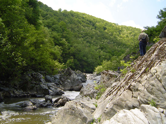
Bedrock in Strandja are sedimentary, igneous and metamorphic. From the coast to the interior of Strandja can see various rock breeds - tuffs and andesites tufobrekchii, sandstone, gabbro and diorite, gneiss and schist. Western part of Strandja is occupied by the extensive karst region - from Varovnik in Youth, Zvezdets, Ivy, Stoilovo to the town and to the south in the Turkish part of it with limestone, marble and granite borders, which are deposits of intermetallic ores. From antiquity to the late twentieth century, are mined copper and iron ores are crushed marble blocks, washing gold. Karst terrain type is determined by the properties of carbonate rocks and particularly their water-solubility. It is developed with a variety of forms: diamonds, pools, caverns, caverns and various size and complexity caves. Ranges and slopes of powerful Karst rock formations, rocky ravines and gorges are formed near Youth, Dokuzak, Petrova Niva and Kovacs.
The northern part of the park, above the line Ugrash - Papazova levels - Bulgaria is occupied by gornokreditni andesite, andesite tuff and sandstone. They are built on deep and powerful soils occupied by durmast, beech and mixed forests.
In the southern parts are dominated by sediments of Upper Jurassic - shale (clay, sandy clay and marl). The soils here are shallow and dry.
Geomorphological development of the territory is the result of a long period of hundreds of millions of years of erosion of the movements of the Earth's crust and also the colorful geology.
Characteristic of the park are rounded forms steep cut in places zhdrelopodobni river valleys (Veleka, R. Young). Deep cut their impact have recent glaciations during which sea level fell by several tens of meters. Firth Veleka, for example, lasts about eight kilometers inland.
For geomorphological processes have important netektonskite movements. Coast sank a few millimeters per year, while other parts of the region are rising.
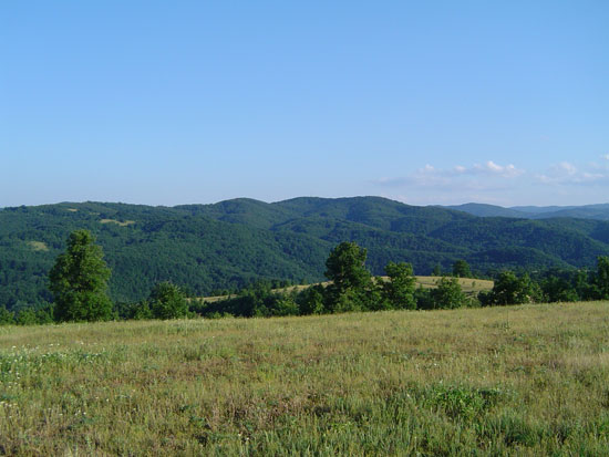
The relief of Strandja is hilly and low. About 38% of the park are high from 0 to 200 m, about 60% - from 200 to 600 meters and about 2% are over 600 m.
|
|